
HISTORY CORNER:
Historic Maps
HISTORIC MAPS FROM THE HSM IMAGE GALLERY
Click for a larger view of each image…
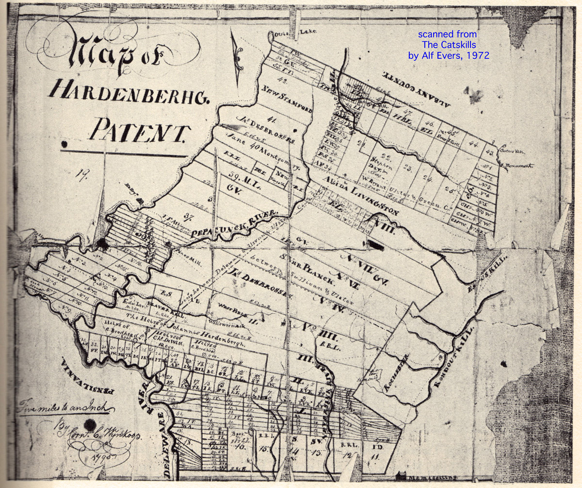
1795 Hardenbergh Patent Map
1795 Hardenbergh Patent Map
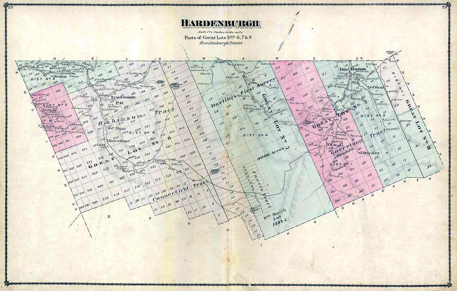
1875 Beers, Town of Hardenburgh, UC Archives
1875 Beers, Town of Hardenburgh, UC Archives

1875 Beers, Town of Shandaken
1875 Beers, Town of Shandaken
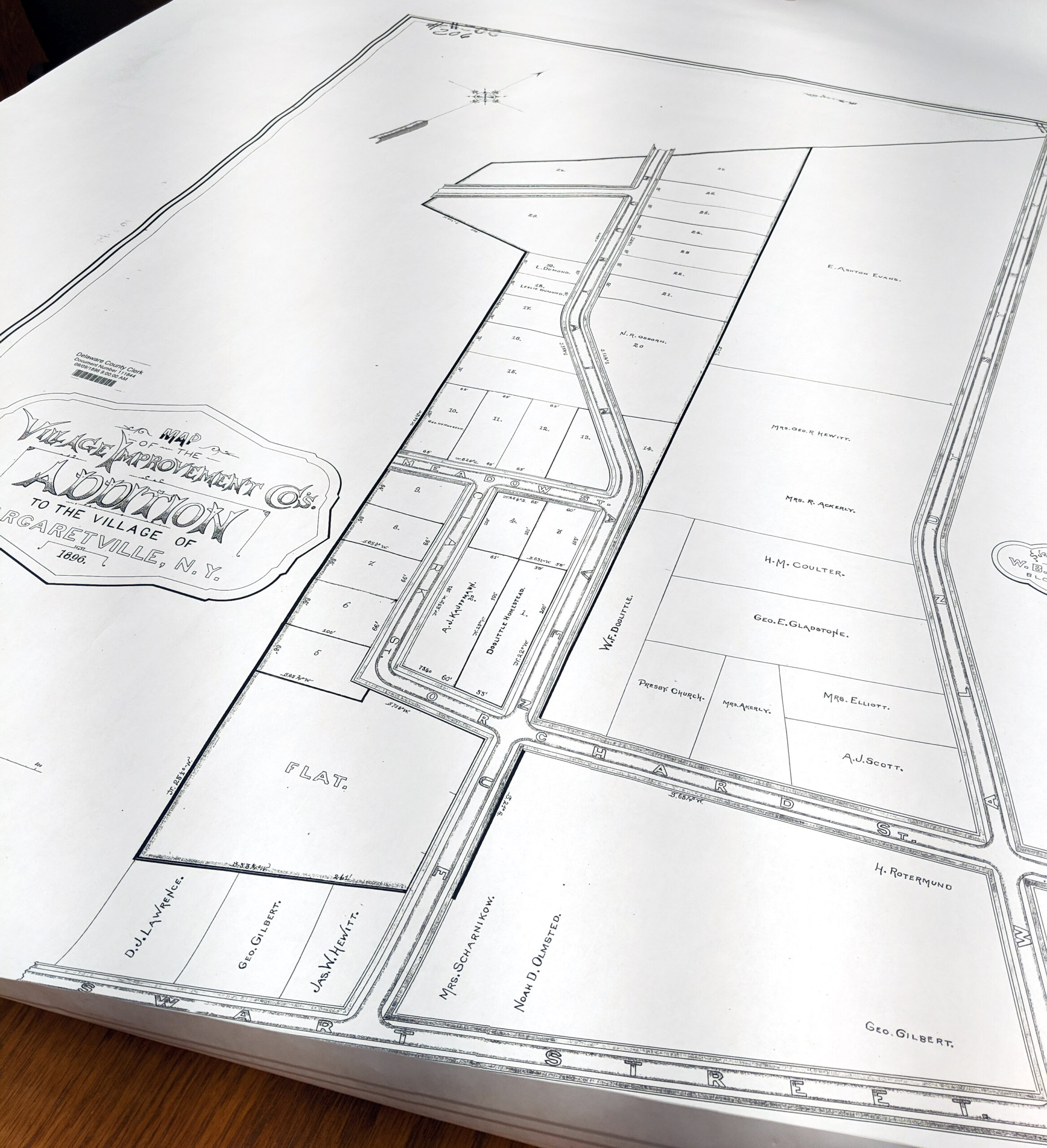
1896 Margaretville Village Improvemt Co map
1896 Margaretville Village Improvement Company map
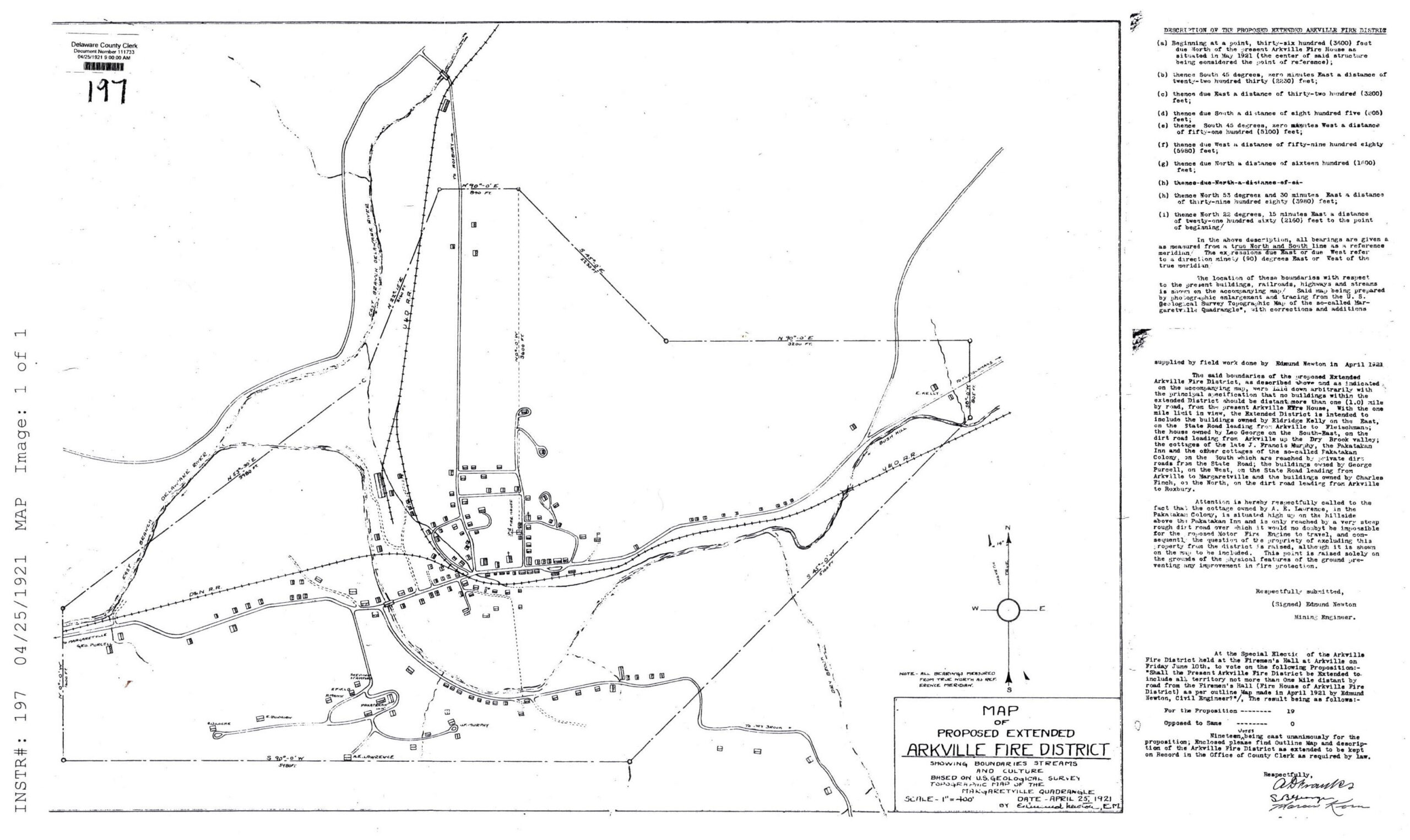
1923 Arkville fire district map, DC Clerk
1923 Arkville fire district map, DC Clerk

EPSON MFP image
1867 Beers, Town of Halcott

Sec 19 IndexArena, BWS taking map
Sec 19 Index Arena, BWS taking map
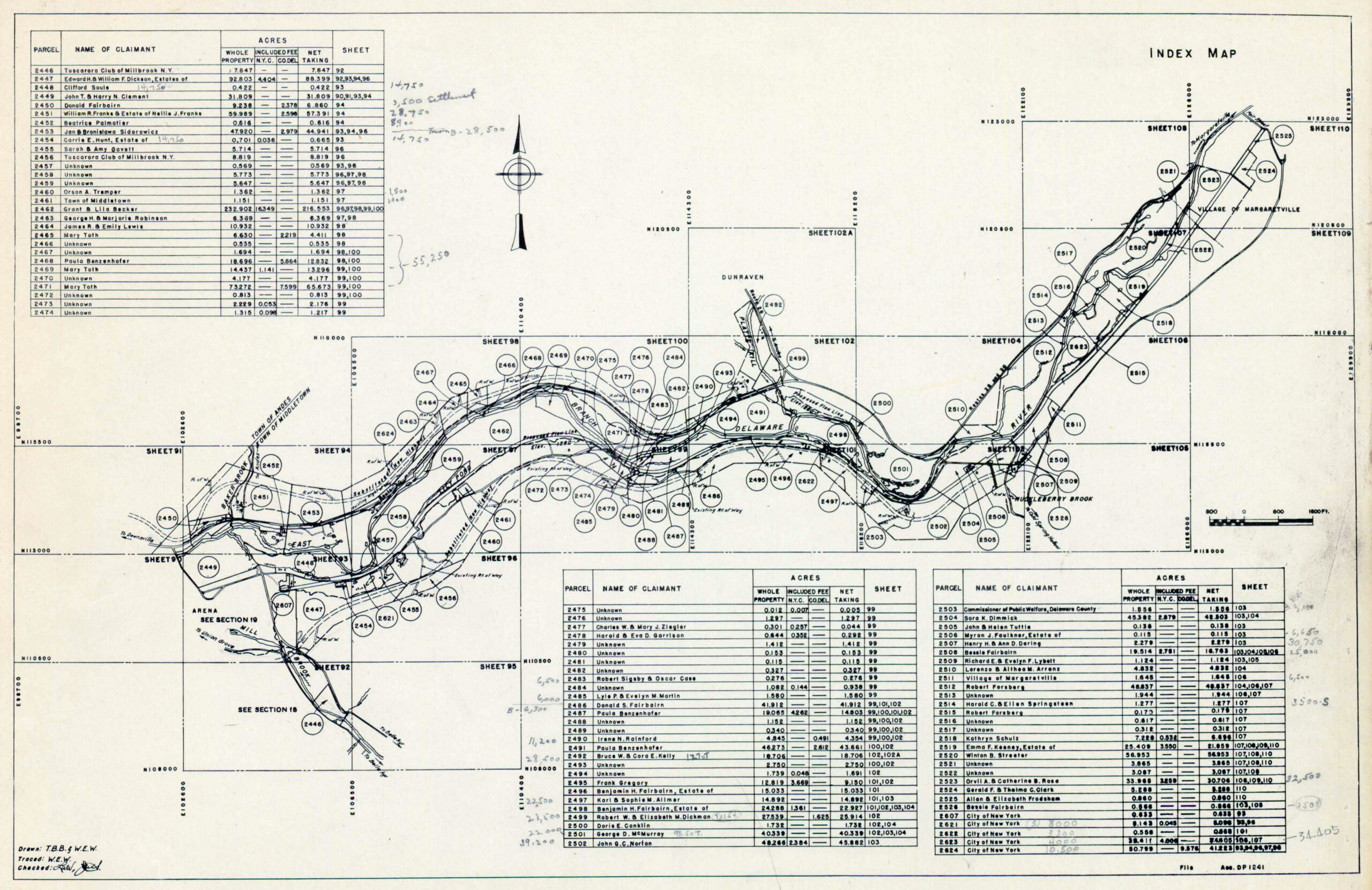
Sec 20 Index Dunraven, Millbrook, BWS taking map
Sec 20 Index Dunraven, Millbrook, BWS taking map
LINKS TO HISTORIC MAPS ON OTHER WEBSITES
Click to open the website page…

1856 Gould Map of Delaware County, Library of Congress

1869 Beers Atlas of Delaware County, individual town and village maps, Delaware County History & Genealogy website

1856 Map of Greene County, including Halcott, Library of Congress

1853 Map of Ulster County, including Shandaken, Library of Congress

1858 Map of Ulster County, including Shandaken, Library of Congress

1912 Sanborn Insurance Maps of Margaretville (Images 1-3), Arkville (Image 4) and Arena (Image 5), Library of Congress

1912 Sanborn Fire Insurance Maps of Fleischmanns and Griffin’s Corners, 5 Images, Library of Congress